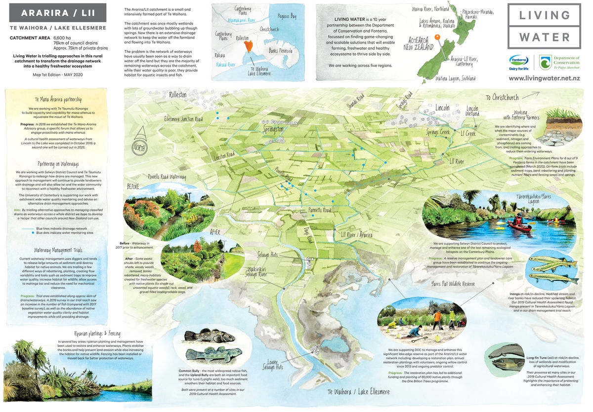
Ararira-LII, Canterbury progress map

Ararira-LII catchment facts
About the area
The Ararira/LII River is a significant spring-fed tributary of Te Waihora/Lake Ellesmere, New Zealand’s fifth largest lake and an important wetland ecosystem. Te Waihora has special significance to Ngāi Tahu as a tribal taonga representing a major mahinga kai and an important source of mana.
Unique features of this catchment include headwater springs, an extensive network of drains and waterways, and two wetland areas – Yarrs Flat and Yarrs Lagoon/Tā-rere-kau-tuku. The catchment’s network of highly modified waterways and remnant wetlands provide some habitat for native fish, bird and plant species although it is severely degraded.
The Challenge
In the Ararira-LII River catchment there has been a significant loss of wetland, freshwater ecosystems and lowland habitat. Water quality is poor due to high levels of suspended sediment, nutrients (phosphorous) and faecal coliforms. Much of this has been caused by various productive land uses in the catchment and modification of the waterway, wetland and lagoon hydrology for drainage purposes.
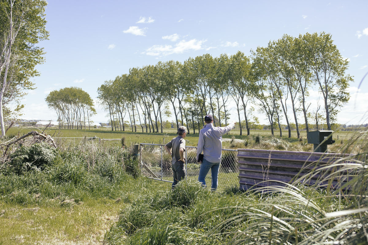
Living Water’s key focus is transforming the drain and water network into a healthy freshwater ecosystem in this productive agricultural landscape.
Projects include developing Farm Environment Plans for Fonterra farms in the catchment, trialling nutrient and sediment reduction interventions on farm, trialling in drain restoration approaches and working with strategic partners on a catchment-wide drain and water network improvement concept.
At a glance
- 6,600ha total catchment area
- 5 main types of farming (dairy, sheep, beef, deer, horticulture)
- 50% of the catchment is dairy farms
- Only 1% of the original vegetation remains on the Canterbury Plains