Catchment Condition Survey
What is a catchment Condition Survey?
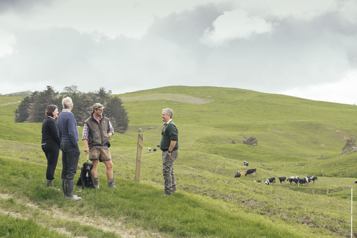
A Catchment Condition Survey (CCS) collects information about a catchment via a physical inspection of properties. While some information about stream structures, such as bridges and culverts, may be recorded on council records if they are publicly owned and maintained, the information could be potentially out-of-date, or non-existent. Issues such as localised flooding, bank erosion or invasive weeds may be well-known to landowners but never have been recorded if no remedial action has been taken by a local council or catchment group. A field survey provides a snapshot of the catchment condition based around an assessment of physical features such as stock access and vegetation along streams, soil erosion, stream structures, and significant natural areas in the catchment. Visiting properties also provides an opportunity to engage with landowners and hear directly from them about issues they’ve identified, such as seasonal flooding and erosion, or pests and invasive weeds, which may not be obvious from simply looking at a waterway on one particular day.
What was the purpose of the Living Water trial of a CCS?
Living Water used a CCS in the Pūkorokoro-Miranda catchment. It encompasses 6,278 hectares of dairy and dry stock farmland and lifestyle blocks between Miranda and Kaiaua villages on the west side of the Firth of Thames. The northern end of the catchment reaches into the native forest of the Hunua Range. The primary features assessed by the CCS were fencing and stock access to waterways and significant natural features, vegetation types along waterways, and erosion. As a secondary focus, the following features were recorded during the survey if they were encountered: instream structures and blockages, weed issues, threatened species presence and any relevant landowner comments.
Dion Patterson

Rose Graham
Who could use a CCS?
Regional and district councils, catchment groups, river care groups, community groups, and iwi.
How does a CCS work?
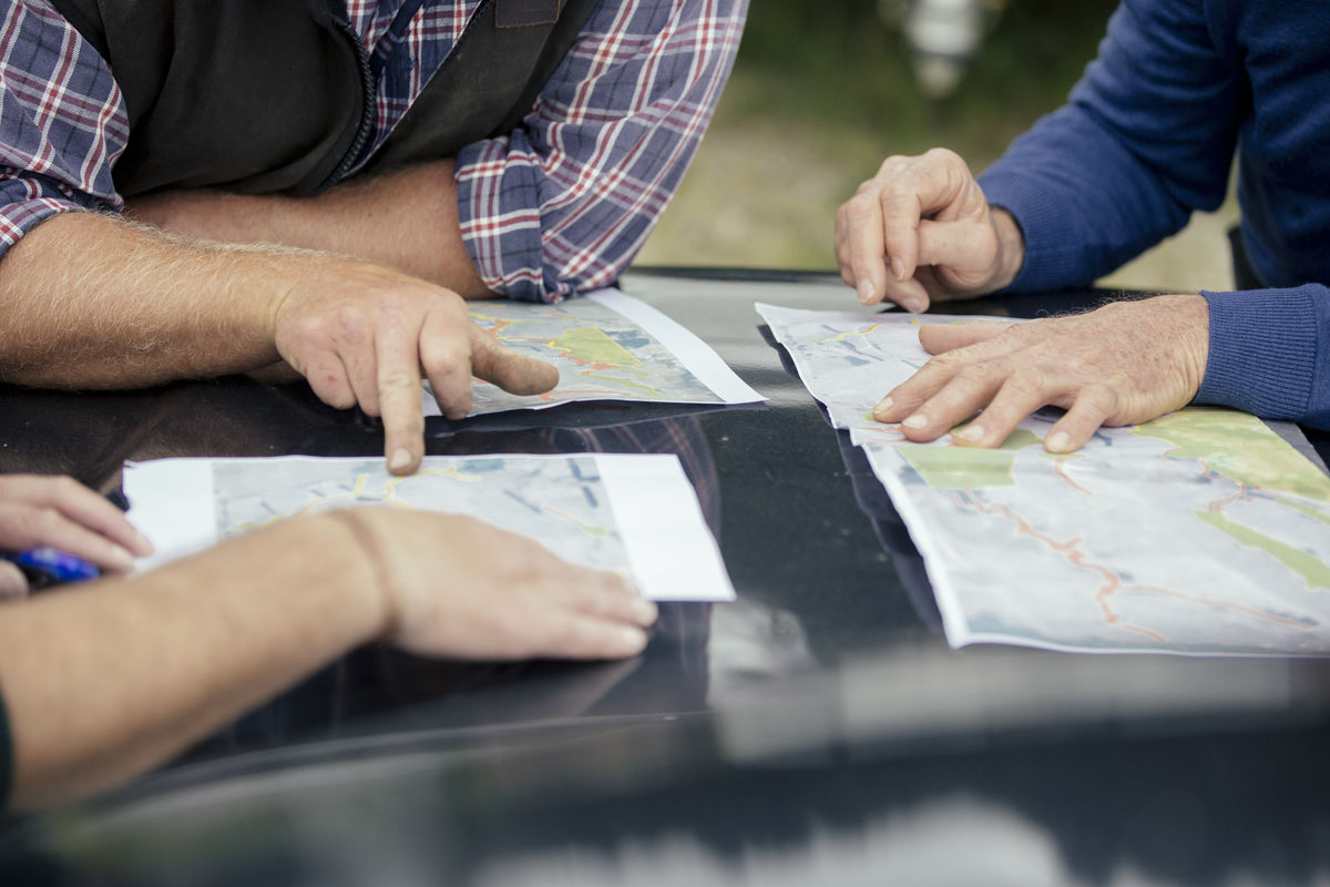
A Catchment Condition Survey identifies key ecological issues in a catchment and establishes baseline information that helps determine priority areas and activities for management. The field survey allows direct engagement with landowners who can share their knowledge of issues and solutions tried over time in their area of the catchment. Collectively, the insights of many landowners add tremendous value to recording the physical and visible aspects of the catchment. The information gathered through the survey is compiled into a series of maps to help identify opportunities for catchment management. Remedial work and interventions, such as fencing, riparian planting and bank recontouring can be identified and priced for landowners. A significant benefit of the mapping is that it enables all the landowners within the catchment to see how freshwater catchments are interconnected. Resolving issues such as erosion and sedimentation that start upstream and compound as they flow downstream require catchment-wide action. The information gathered can help identify priority actions at both the individual property and catchment scale enabling both small and large scale action as and when it can be afforded by landowners and community groups.
What did Living Water learn from the CCS in the Pūkorokoro-Miranda catchment?
The CCS showed proportions of stream lengths that are stock proof, or have the potential to be completely stock proof, and if they link significant natural areas through farmland. It identified where streams are already fenced on one side, and therefore require only half the resources of an unfenced stream to become stock-proof. Erosion hotspots were also identified, as were perched culverts for remedial fish passage works.
Where is more information available about a CCS?
Living Water used a CCS developed by the Waikato Regional Council, used in their river catchments
Marlborough District Council’s Catchment Care programme launched in 2020 uses a CCS
"A significant benefit of the mapping is that it enables all the landowners within the catchment to see how freshwater catchments are interconnected"