Initial information collected at site
What is initial information gathering?
After Living Water had selected its five catchments, one of the next steps was gathering together all the existing information about the catchment to build a picture of what was happening with land use, biodiversity and freshwater quality. This process enabled the identification of gaps in data so new or additional research could be undertaken to build a fuller and more accurate picture of water quality along with information about the hydrology, geology, land use and other characteristics that impact upon water quality within a catchment.
Why does initial information gathering matter?
It’s important to have an accurate picture of the forces at play in a catchment before implementing any interventions to improve water quality. For example, you first need to know what pollutants are an issue, and where. To address the issue of sedimentation in a waterway requires knowing the source or location of the sediment and how it’s entering the waterway. Without that information any interventions, such as detention bunds or sediment traps could be located in the wrong place, sized incorrectly and not improve water quality or even make it worse. The more information that’s known about a catchment the better the understanding of the issues and the more focused the intervention to address the problem.
It’s important to have an accurate picture of the forces at play in a catchment before implementing any interventions to improve water quality
How did Living Water go about gathering information?
Living Water began by researching and reviewing all the existing data and information collected by regional councils, district councils, Crown Research Institutes and DOC about water quality in the five catchments selected. To identify the impacts on water quality it’s important to have data recorded over a reasonable time period (at a minimum a year and ideally over several years). The initial desktop analysis revealed a lack of data in some of the catchments Living Water had selected.
How did Living Water fill in the gaps in the data?
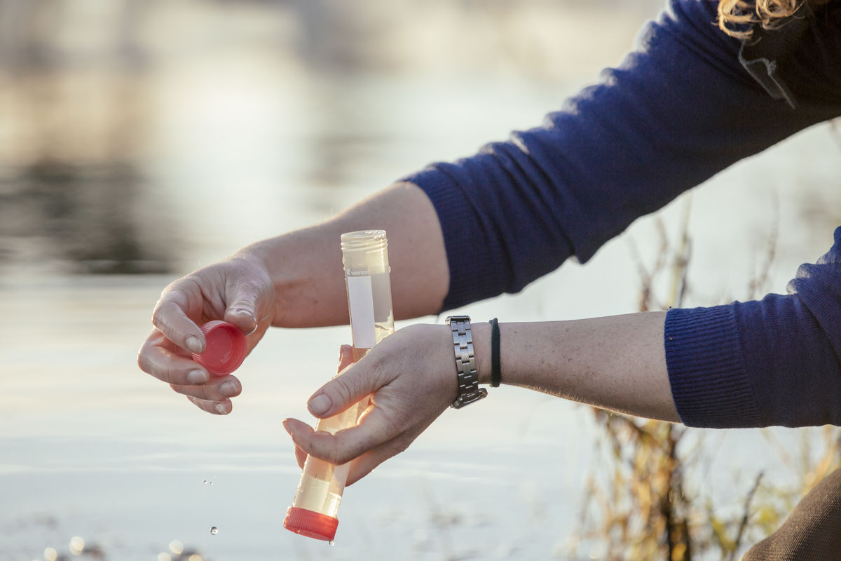
Living Water commissioned its own research within each catchment to conduct overall assessments related to freshwater, including water quality, land use, hydrology, geology and locating any spatial data that was available. All the existing research was reviewed and recommendations made where additional ‘on the ground’ research was required to build an accurate picture of the catchment. In some catchments this led to follow-up research over 3 to 6 months. Other catchments, such as in Canterbury where springs only flow at certain times of the year, required a year-long cycle of monitoring to really understand the forces impacting upon water quality. An initial learning from the research phase was that a ‘one size fits all’ approach won’t work, and that each catchment had its own characteristics and needed to be approached individually and uniquely.
How did Living Water know it had sufficient information to proceed?
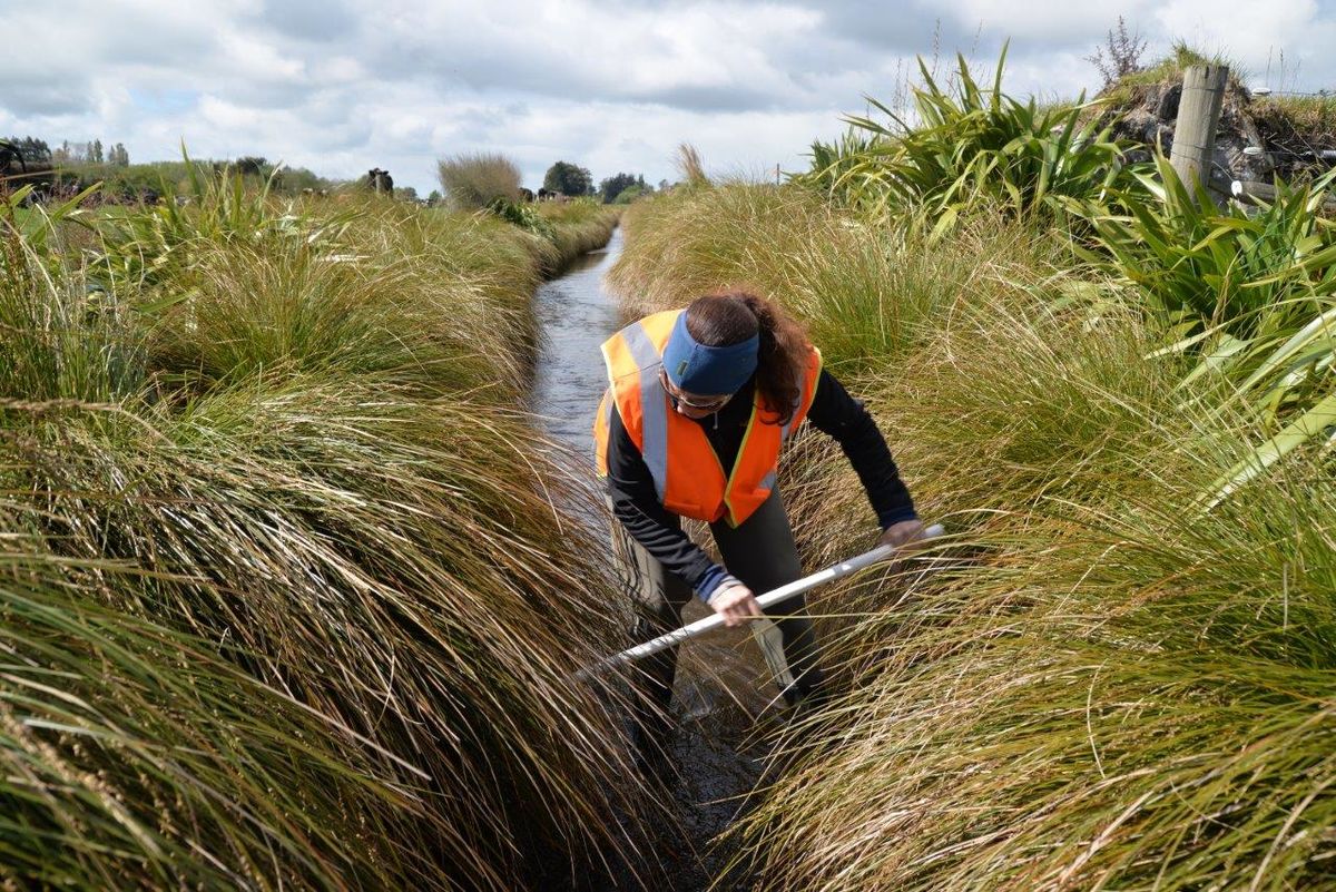
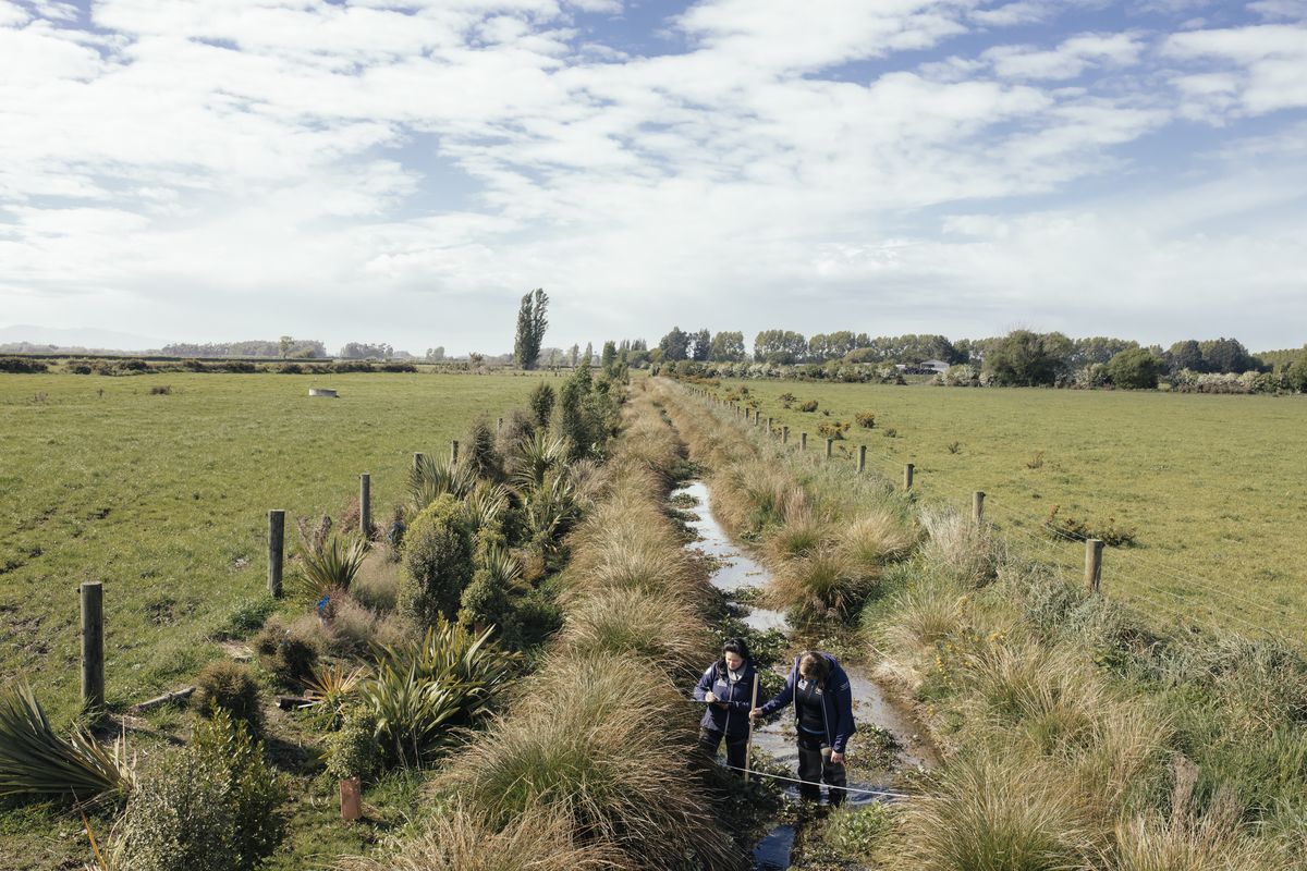
Scientists will often say more research is required. Living Water had another information gathering tool available to check the collected data against ‘on the ground’ sightings and local knowledge. In both the Wairua and Pūkorokoro-Miranda catchments Living Water conducted a Catchment Condition Survey.
These are on the ground surveys conducted in person and involve walking the catchments, sighting and recording all the impacts upon a catchment and the water quality, such as fencing, bank subsidence, riparian planting, culverts and drains, bridges and barriers. The surveys also involve talking to local landowners to tap into their knowledge and ‘lived experience’ of catchments. Local landowners can often explain variations in data by sharing their memory of droughts, floods, landslides and other events that impact upon water quality. The combination of sighting and recording what’s happening along a catchment, together with the knowledge of local landowners, complements the recorded data to build a complete picture.
In Wairua once the research was completed, and along with research focused on the catchment hydrology completed by an MSc student, there was enough information to accurately identify where the sediment in the waterways was coming from and trial interventions (detention bunds) located where they were most likely to improve water quality by preventing the sediment travelling downstream.
What did Living Water learn from the process of gathering initial information?
Making an immediate impact on water quality requires in-depth knowledge and high-quality information about a catchment. Many organisations are already gathering information which is freely available, so it makes sense to access existing data to identify the gaps before rushing into research which can be costly and time-consuming.
Tools such as the Catchment Condition Survey are affordable practical methods of gathering information and engaging with local landowners and iwi/hapū to tap into the knowledge and lived experiences of people who understand the catchment in ways data can’t always reveal. While western science can provide accurate measurement of current water quality, geology, hydrology and land use, only those with a longer-lived experience of the land can provide insights into what change has occurred to water quality over decades and centuries.
Living Water is supporting the development of a new spatial mapping tool called ‘LandscapeDNA’. The project has grown out of the understanding that because New Zealand is so geologically diverse, the make-up of the landscape (such as soil type, geology, gradient, hydrology) can end up having more impact on outcomes for water quality than the type of land use on its own. This is hugely significant because for years farmers have been changing their use of fertilisers to reduce nitrogen run-off entering waterways, often to little or no effect which has been intensely frustrating for farmers wanting to do the right thing for the environment and their farms.
The LandscapeDNA project provides an in-depth picture of landscape characteristics underground which will enable farmers to understand why and how their land is contributing to water quality, and what decisions they need to make about future land use to improve water quality.
Who could use this information?
Catchment groups, landowners, regional and territorial councils, people working in catchment and land management.