Data-driven solutions for freshwater improvement
A key lesson from Living Water, the ten-year partnership between the Department of Conservation (DOC) and Fonterra is while on-farm mitigations and interventions are important for reducing contaminants reaching waterways, an integrated catchment approach will have more impact on freshwater improvement.
Department of Conservation Freshwater Science Advisor, Dr Katie Collins uses the analogy of a leaky house, “If you had a leak in your house, you need to mop up the areas that are wet, then you need to find the source of the leak before you can fix it.” Farm Environment Plans (FEP) are a great tool to identify what can be done on farm, but they don’t always go as far as identifying the source of the issues, which will differ from catchment to catchment, says Dr Collins.
In the early years of the partnership, Living Water was involved in digitising the FEP process to meet Fonterra’s goal of all farms having completed an FEP by 2025. This also allowed the input of DOC staff to ensure freshwater and biodiversity considerations were included. “Through this process we saw how great these are for individual actions like fencing waterways, setbacks from waterways and reducing fertilisers and other chemical inputs, but they don’t always get to the sources of the leak” says Dr Collins.
To kick off our work in the five catchments, Living Water commissioned baseline ecological assessments, including water quality, land use, hydrology, geology and locating any spatial data that was available. “We looked at all the available data from councils, research institutes and DOC, as well as the data we commissioned to build a picture of what was happening with land-use, biodiversity and freshwater quality. Once we knew the sources of the leaks, we could start working on fixing them.” Says Dr Collins.
Katie Collins
Sarah Yarrow
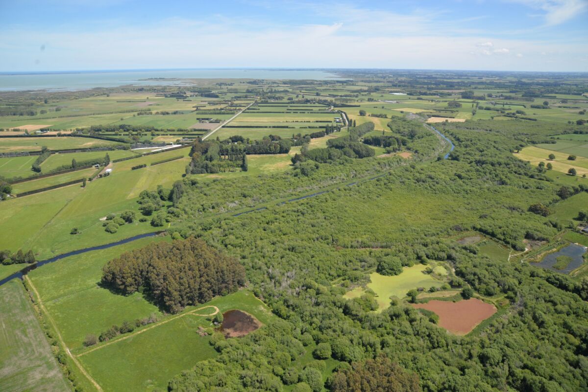
Collecting catchment scale information
A range of methods were used to gather initial data in each of the five catchments. The smaller catchment size of the Wairua, Northland and Pūkorokoro-Miranda, Hauraki catchments meant we could conduct Catchment Condition Surveys. These ground surveys were conducted in person, by walking the catchments, sighting and recording relevant impacts upon a catchment and water quality, such as fencing, bank subsidence, riparian planting, culverts and drains, bridges and fish barriers.
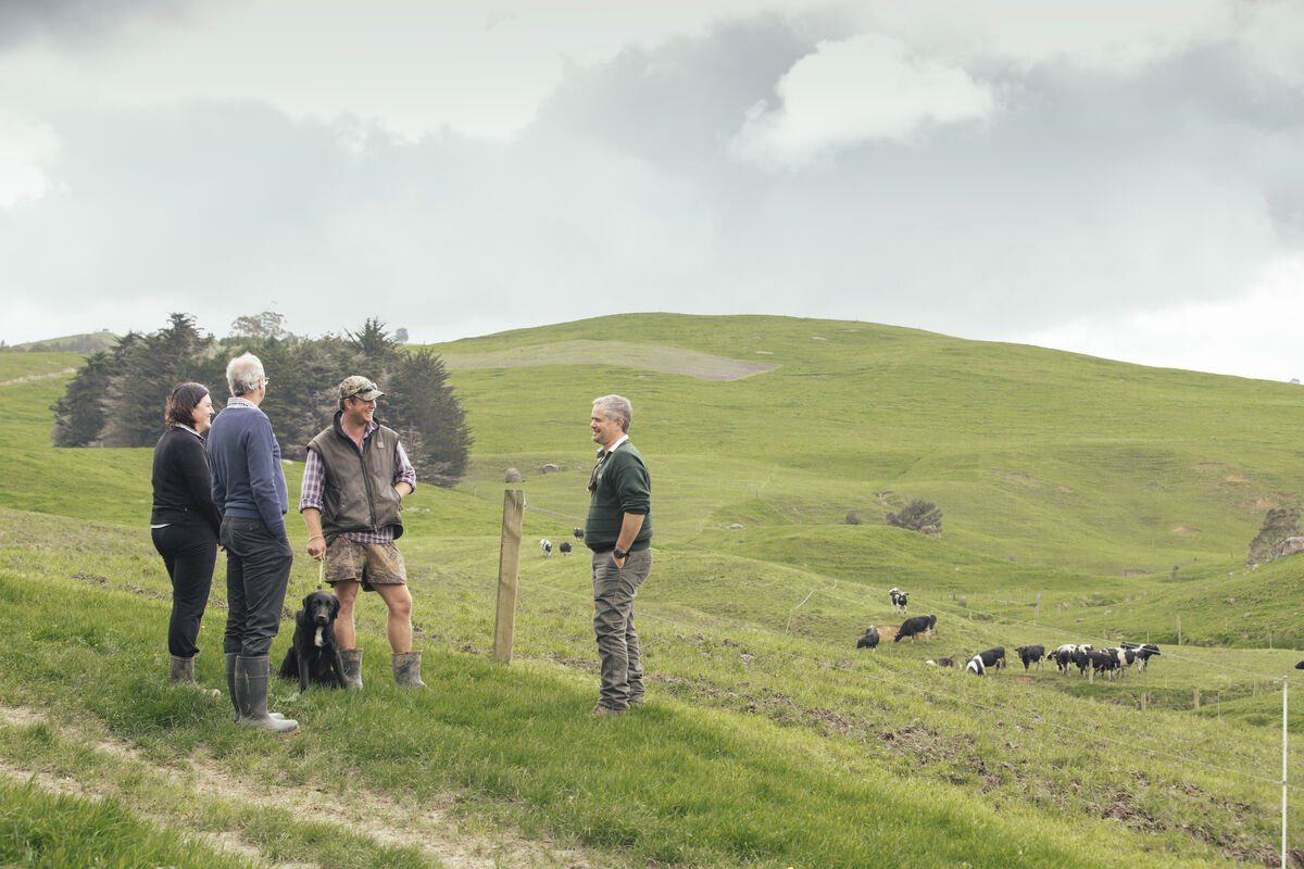
“Because these surveys are done in person, we had direct engagement with landowners who shared their knowledge of issues and solutions tried over time in their area of the catchment”, says Living Water National Manager, Sarah Yarrow. “Collectively the insights of many landowners add tremendous value to the recording of the physical and visible aspects of the catchment. The survey also helped increase landowners’ awareness of environmental issues and gave them a view of their property in the context of a wider catchment. Understanding how run-off from your farm impacts landowners downstream is very important for getting communities to act together to improve water quality.”
Survey information from Pūkorokoro-Miranda was loaded into the GIS based CAPTure tool, the combined data creates a snapshot of the catchment’s condition and prioritises where remediation activities need to be targeted. Catchment condition surveys were completed in Pūkorokoro-Miranda in 2017 and Wairua in 2018 and again in both catchments in 2023 to record and analyse both biophysical and social changes in the catchment over time.
In the Ararira-LII, Canterbury, we partnered with the University of Canterbury’s CAREX group to identify the locations and extent of major issues affecting the catchment, like flooding, excessive sediment and nutrients, invasive aquatic weeds and poor habitat in waterways. “The findings here were really interesting” says Yarrow. “Routine mechanical clearance of aquatic weeds and sediment has created steep-sided, straight drains that are designed to remove water quickly. This makes their banks unstable and prone to collapsing, generating more sediment. A lack of shading across the waterways encourages the growth of aquatic weeds, so we get stuck in a cycle that’s ultimately causing more issues.” Read CAREX’s findings here.
Waituna Lagoon, Southland sits at the bottom of a complex catchment that’s farmed intensively, part of the catchment’s wetland area has been designated a Ramsar Wetland of International Importance. “The complexity of this catchment required a different approach,” said Yarrow. Living Water commissioned Land and Water Science to complete a physiographic project to map how water (and contaminants within it) travel above and below ground under different levels of rainfall. “It gives everyone in the catchment a better understanding about where best to put contaminant management interventions to improve water quality leaving farms. The mapping shows where high sources of contaminants are likely to be, then the right tool can be used in the right place along with better land management practices” said Yarrow.
LandscapeDNA builds on physiographics by providing a site-specific assessment of properties, right down to paddock scale. “Traditional FEPs do not consider landscape data. LandscapeDNA information can be integrated into FEPs to support on-farm actions and understand how contaminants move through the water system.” Said Yarrow. In addition, all parties involved in a catchment can access the same data, on the same platform.
Innovations like real-time water quality monitoring and LandscapeDNA make data accessible to all involved in catchment projects where previously this data would be held by a single agency or be spread across multiple agencies. “Access to continuous, accurate data empowers and inspires change by making it easier to make evidence-based decisions on interventions and land-use change. It also helps everyone understand where they fit in the catchment and how on-farm changes, community efforts and restoration work connect to catchment wide aspirations.” Says Collins
“Living Water also worked with iwi and hapū to understand mana whenua aspirations, explored ways to weave mātauranga Māori into aspects of Living Water’s work and co-designed solutions for catchments.” Said Yarrow.
In the Ararira-LII catchment, Te Taumutu Rūnanga facilitated a Takiwa health assessment, developed by Te Rūnanga o Ngāi Tahu to tangibly measure the mauri of an area in a way that can be incorporated with western science.” Said Yarrow (watch the video here). It enables the gathering, storing and analysis of information from iwi, both historic and current, on matters important to mana whenua, including cultural heritage and past mahinga kai. The data can be used to report on the cultural health and mauri of a freshwater environment. Living Water strongly supported integrating Mātauranga Māori into farm planning, this was tested at a Fonterra demonstration farm with the addition of social and cultural elements added to Fonterra’s Tiaki (FEP) tool. This work, led by Ngā Kaitiaki O Ngā Wai Māori in the Wairua River catchment, has now seen a “whakapapa” section added to farm plans that notes the farm's history and mana whenua of the area.
“The abundance and diversity of aquatic life (or lack of) makes up part of an overall assessment,” says Dr Collins. Living Water, in partnership with others, carried out regular fish surveys in the Wairua, Waituna and Ararira-LII catchments. “We saw increases in abundance and biomass of native freshwater fish in the reaches of Powells Road, Ararira-LII and Waituna Creek, Southland where we had restored habitat and stopped using mechanical clearance.” Similarly, at the Waikato Peat Lakes sites, spotless crake/pūweto monitoring was used as an indicator of how successful restoration efforts were.
Regular water quality monitoring was carried out to assess the initial state of water quality and responses to smaller-scale interventions trialled. Living Water took the opportunity to trial real-time water quality monitoring sensors that measure data hourly. “Monthly data provides good information for establishing long-term trends and in large, stable bodies of water but results can be highly weather dependant and collection of samples is time consuming,” says Dr Collins. “Real-time water quality monitoring allows us to see daily patterns and changes as they happen, including the impacts of high rainfall events and different flows.” Says Dr Collins.
“This information identified the main water quality issues each catchment was facing, or the source of the leak” explains Dr Collins. “We could identify the extent of the major issues affecting each catchment which could be flooding, excessive sediment, high nitrates, poor ecological habitat, invasive weeds - to name a few, or it could be a combination, which we found are usually connected.”
The interconnectedness of ecosystems and communities
Water flows through catchments regardless of boundaries and land use differences, and degraded water quality affects the entire catchment. This is why improving water quality requires a whole system approach – the entire network is connected, at an ecological level, a physical level, a social level, and they need to be approached together.
“Through this process, we learnt that farmers just doing their very best on their farms won’t be enough to restore healthy functioning lowland ecosystems” says Yarrow. The scale of the freshwater issues doesn’t sit neatly within farm boundaries or on conservation land, or even solely within the dairying sector.
Living Water provided an opportunity to forge new partnerships with farmers, scientists, councils, mana whenua and local communities to make a real difference for freshwater in New Zealand.
“Successful change requires landowners and stakeholder in a catchment working together with iwi, councils and government because no one organisation or entity has all the answers or resources”, says Yarrow. “Our projects have shown that catchment-level approaches are more likely to produce better outcomes in the long-term than a farm-by-farm approach.” Working together has other benefits. The costs of remedial activities can be shared rather than falling to one landowner, and groups with a catchment plan can access funding, which can make an enormous difference”, says Yarrow.
To do this, science must be accessible to inform decision-making. Natural landscape attributes and processes can affect water quality outcomes more than farm management, so this new science and data needs to be accessible, and used together with local landowner history and mātauranga Māori to achieve the best solutions for freshwater and ecological health.
<-- Previous story: Lessons in improving freshwater ecosystems in farming environments
Next Story --> It’s more than a drain